
Search an Owatonna Street by Address
An Owatonna street search works best as a chain of separate checks. Start with a current address and use the assessor to identify the Owatonna property, not a presumed occupant. Match that result to Owatonna city or county parcel geometry, then use the legal description and recorded parties to investigate the Owatonna deed history. A current registration confirmation can be relevant only for a specific person at a specific address, and it is not a street roster. For older households, a reverse or criss-cross directory can place a printed name at an Owatonna address in a particular year.
- Normalize the Owatonna delivery address with the official USPS lookup, preserving directional words, unit details, and the street suffix.
- Search the Steele County Assessor for the Owatonna property by address, parcel number, or legal description and note the situs address and parcel identifier.
- Compare the Owatonna parcel in the GIS map. Inspect parcel geometry, building footprints, subdivision lines, and municipal-boundary context.
- Use the Owatonna parcel or legal description in the Recorder index, then follow recorded grantor and grantee references backward through the available deed chain.
- Use Minnesota's voter tool only as a lawful, individual confirmation with the required name, date of birth, and exact Owatonna address. Historical Owatonna directories are the better route for a dated address listing.
Each Owatonna result establishes a narrower fact. The assessor can display a current property record; a deed identifies recorded parties; a directory supplies a historical printed listing. None alone proves every person who has lived at an address.
Normalize an Owatonna Street Address
Postal format, parcel situs, owner mailing address, and a recorded-party address often differ. A situs is the physical location of the Owatonna parcel. A mailing address may be a post office box, agent, lender, trust, business office, or another residence. The USPS ZIP Lookup confirms delivery formatting, not that a person or company is present there. Enter the street, city, state, and ZIP, with an apartment or suite when applicable, before carrying the spelling into Owatonna local records.
Owatonna's city and county GIS systems also have different roles. County GIS maintains tax parcels, rural addresses, and NG-911 work. The city service is useful for municipal layers. If a result falls near an annexation line, treat postal, parcel, and municipal-boundary evidence as separate layers rather than forcing them into one address label.
Note: Retain the original address spelling and query date because a unit number, direction, or suffix can change a portal match.
Owatonna Street Directory Assessor Fields
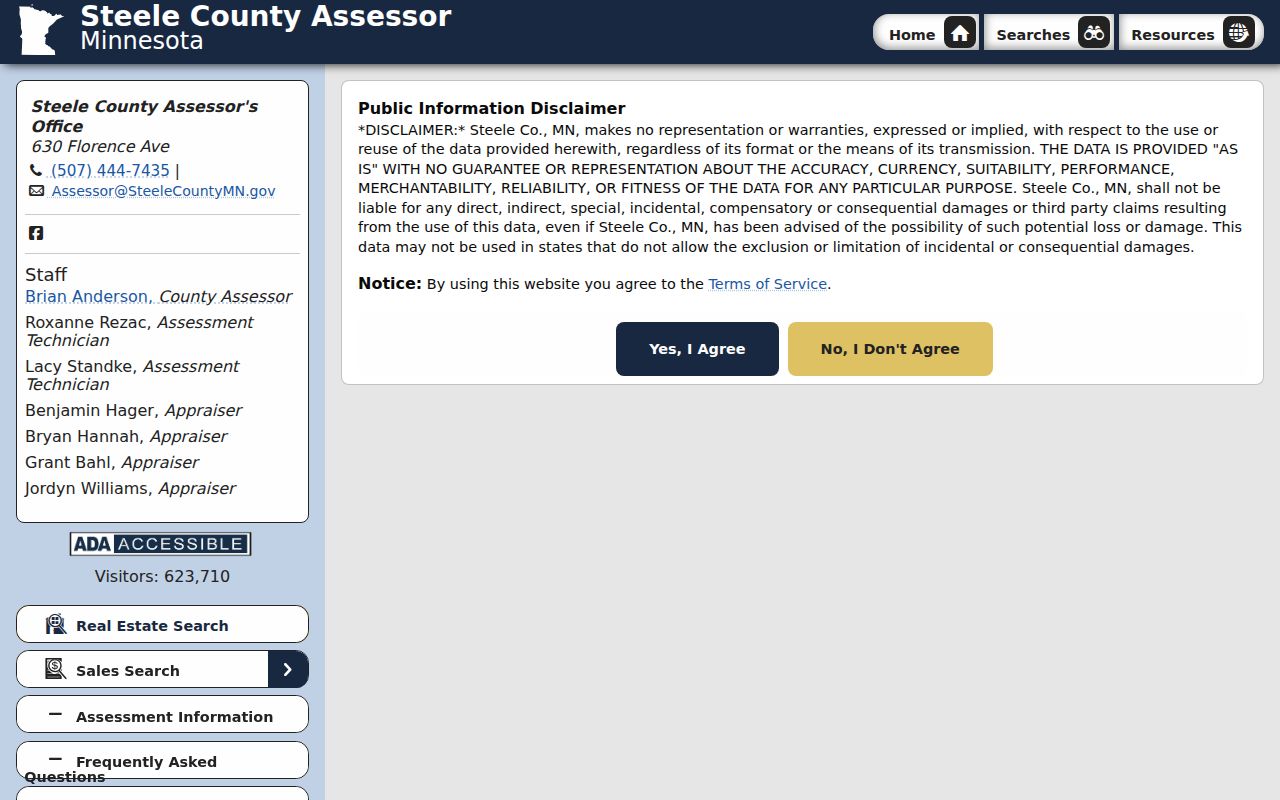
The Steele County Assessor search begins behind a consent screen, so its live form order was not verified during the research. Its published guidance does identify the concepts available for Owatonna property work. Use a house number and street when possible, then narrow with a parcel or legal description when a broad Owatonna street term is ambiguous. The assessor supplies public-facing information as-is, while the recorded instrument remains the stronger title source.
| Assessor field | Use in an address search |
|---|---|
| Address | Find the Owatonna property situs using a normalized street address. |
| Parcel Number | Carry the Owatonna parcel identifier to GIS, Recorder, and request correspondence. |
| DBA | Use a doing-business-as name only where it is relevant to the Owatonna property record. |
| Legal Description | Bridge an Owatonna street address to older deeds, plats, and tract language. |
| Section | Narrow a description for Owatonna land records in township-based references. |
| Township | Distinguish township geography around Owatonna from the city mailing label. |
| Range | Pair with section and township for a legal description in Owatonna. |
| Lot | Check an Owatonna plat when the field is populated. |
| Block | Check an Owatonna plat when the field is populated. |
The Assessor's published guidance says Lot-Block is the one field not being populated in the current system. Deeded acres may also be blank, especially for residential property. A blank Lot or Block does not show that an Owatonna plat lacks those details. Ask the Assessor, at 507-444-7435, or county GIS for the right Owatonna parcel format and use mapped data for lot size or dimensions.
The assessor search screen shows the consent step that separates the entry page from the property search.
After consent, verify each returned Owatonna field against the parcel itself and save the annual assessment year when comparing records over time.
Map Owatonna Street Directory Layers
The Owatonna ArcGIS MapServer provides a street-level map layer set that the assessor card does not. For Owatonna, it supports query, identify, and export, with a maximum record and selection count of 2,000. Its named layers include Municipal Boundary, Parcels, BuildingFootprints, Sub-Divisions, Easement Outline, Easement, Zoning Districts, Flood Hazard Zones, Airport Zoning, and DevelopmentFeeAreas.
For an Owatonna street directory search, begin with Parcels and BuildingFootprints. Add subdivision and easement layers to understand Owatonna mapped context, then use Municipal Boundary to distinguish Owatonna city geography from a postal place. The Owatonna city service did not verify owner-name fields, so names should come from the Assessor or Recorder instead. An Owatonna GIS line is reference material, not a legal survey, title opinion, proof of occupancy, or a private-boundary agreement.
The Owatonna city GIS layer list is a useful starting point before narrowing an Owatonna street to a small parcel envelope.
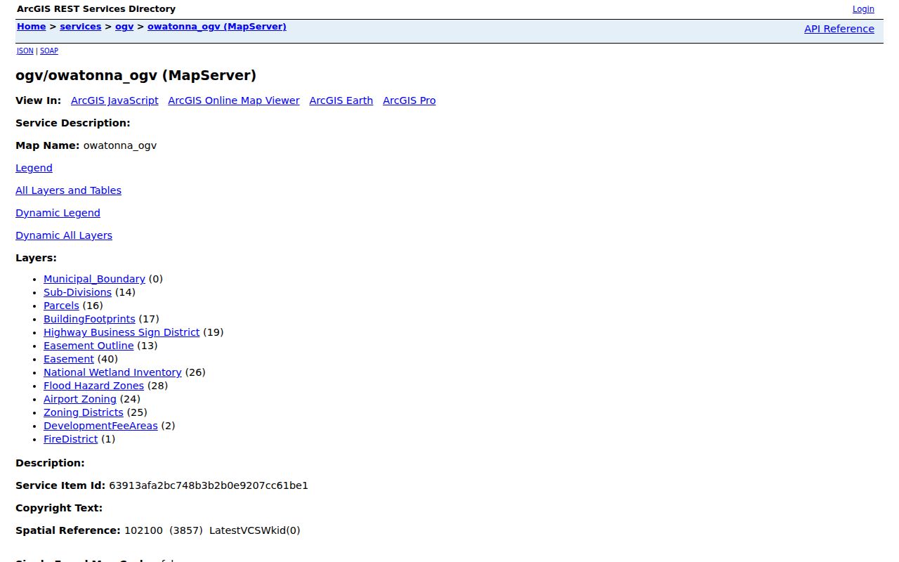
Record the Owatonna layer name and map date with any result, especially where Owatonna city and county parcel displays use different update vintages.
Trace an Owatonna Street Deed Chain
An Owatonna street address is a starting point, not always the best deed key. The Steele County Recorder directs occasional users to Tapestry and offers Laredo Anywhere by contract and monthly minute tiers. The county page does not publish a verified online index-start year, exact Steele document-type list, image fee, or result cap. If an image is gated or the search ends early, ask the Owatonna Recorder whether the record is at the counter, in an offline book, a Torrens file, or available through a written request.
For an Owatonna parcel, search the current owner as grantee, identify the prior grantor and document number, then repeat. Search alternate legal descriptions, trusts, estates, business entities, spouses, subdivision details, section-township-range, and parcel or tract references. Record the document type for the Owatonna parcel, recording date, parties, book/page or instrument number, legal description, prior reference, and whether the result is index-only. Easements, plats, mortgages, releases, assignments, satisfactions, probate transfers, and annexation documents may explain a change without replacing the principal deed owner.
The Fidlar Tapestry landing page is the remote entry point for the Owatonna Recorder's grantor-grantee research path.

Use Owatonna-specific county results with the Recorder's local instructions, because a generic Tapestry guide does not establish Steele County's live fields or historical depth.
Owatonna Street Record Coverage
Address-keyed sources answer different questions along an Owatonna street. Keeping their limits visible prevents an assessed owner, listed directory resident, recorded party, or permit applicant from being mislabeled as the same thing.
| Address record | What it can show | Where and access | Limit |
|---|---|---|---|
| Owatonna Assessor parcel | Owatonna situs, parcel, assessed owner display, legal description, and property facts | Owatonna Assessor address, parcel, or legal-description search | Not a complete title or occupant record; live fields follow the consent gate |
| Owatonna county or city GIS | Owatonna parcel shape, structures, easements, zoning, and boundary context | Owatonna GIS Hub or city MapServer | Reference map, not a survey or confirmed city-service owner field |
| Owatonna deed or easement index | Owatonna recorded parties, date, instrument, and legal description | Owatonna Recorder Tapestry, Laredo, counter, or written request | Online depth and images are not fully verified |
| Owatonna voter registration | Individual registration confirmation at a specific Owatonna address | Minnesota voter tool with name, birth date, ZIP or county, and address | No bulk street roster, protected registrations, or historic-residence proof |
| Owatonna permit or inspection | Dated Owatonna construction or alteration activity | Owatonna Building and Planning inquiry or public-data request | Historical search fields and all visible parties are not verified |
| Owatonna city directory | Historical Owatonna printed occupant or business listing | Owatonna Public Library, SCHS, or a documented collection volume | Missing years and no current-status or legal-title proof |
A Minnesota voter registration lookup requires first name, last name, date of birth, and address information in ZIP or county mode. It updates nightly, but a mismatch may reflect formatting, recent processing, a protected status, or an input error. It does not establish that a person moved or does not live in Owatonna.
Owatonna Street Directory Terms
These terms keep the land-record trail clear when an Owatonna street result uses legal rather than postal language.
- Parcel
- A mapped Owatonna land unit identified by a county parcel number for assessment and GIS purposes.
- Situs address
- The physical address assigned to an Owatonna parcel, distinct from an owner's mailing address.
- Plat
- An Owatonna recorded map that lays out lots, blocks, streets, and related legal descriptions.
- Criss-cross directory
- An Owatonna directory arranged by address so a reader can work from a street to a printed household or business listing.
For a historical Owatonna address, preserve both the printed street form and the legal description. A present street number may not appear in an older instrument.
Owatonna Street Permits and Dates
After a parcel is identified, a building file can add a date to the address timeline. Owatonna Building Permits lists categories such as additions, foundations, framing, final new construction, roofs, windows, siding, decks, demolition, moving, solar, pools, and grading. Those files can show that an application or inspection occurred. They do not prove that someone lived at the property.
The city lists 540 W Hills Circle and 507-444-4370 for Owatonna inspection questions, with at least one day of notice before 4:00 p.m. The research did not verify a public historic permit-search form. Ask for a specific Owatonna address, date range, and record category, and ask whether material is in OpenGov, Laserfiche, paper, or another city system.
Note: A permit is best used to date physical work or a file event, not to identify an occupant at the address.
Owatonna Streets Across Annexations
Owatonna's street geography is not fixed across time. A 2021 city map places the municipal boundary alongside Clinton Falls and Owatonna townships, local sections, and I-35. Boundary records include a 1989-1990 annexation docket for 46.17 acres from Owatonna Township and a 2002 ordinance covering 19.93 acres in Section 5. A rural-route or township address in a historical directory may therefore describe land that later falls inside the city boundary.
No official comprehensive street-renumbering schedule or exact renumbering year was located. Do not invent a conversion. Bridge an older result with its legal description, plat book, directory volume, annexation record, and USPS normalization, then ask the appropriate custodian for a gap that remains.
Owatonna Street Directory Fallbacks
When an online Owatonna street directory trail stops, move to the custodian that holds the missing layer. The Recorder and Assessor are at the Steele County Administration Center, 630 Florence Avenue, and the Recorder's phone is 507-444-7450. County GIS is in the lower level at the same address and can be reached at 507-444-7486. Steele County's election official can address registration-processing questions at 507-444-7410. Ask first whether the item is online, at a public terminal, in a paper book, in a document system, or held elsewhere.
For existing government data, a focused request under the Minnesota Government Data Practices Act should name the department, address or parcel, date range, record type, requested format, and whether inspection or copies are sought. The office is not required to create a new street-wide resident list. For pre-digital address clues, Owatonna Public Library Local History has city and county directories from 1892-present, while the Steele County Historical Society provides Polk directories, plat books, obituaries, and family-history holdings.
Owatonna Street Directory Limits
An Owatonna street directory cannot produce a verified household list. Parcel ownership can differ from residence, a postal result only validates delivery format, city GIS does not confirm owner names, and voter registration is an individual confirmation service with legal limits. Safe at Home participants and protected voter records must not be inferred from gaps. Keep assessor, Recorder, GIS, voter, permit, and historical-directory findings separate and dated.
Lawful use. Use Owatonna address records for personal, lawful research such as family history, estate work, civic questions, or property curiosity. Do not use any record to stalk, harass, intimidate, or harm another person.