
Owatonna ZIP Code Directory Coverage
Postal references near Owatonna need a careful label. The research clearly verifies 55060 through the Owatonna post office. It also finds 55049, 55053, and 55057 in nearby or Owatonna-related postal-routing material, but those references do not establish city-proper residential coverage. Check a full address in the official postal tool before assigning a ZIP to a person, parcel, or municipal location. A delivery area can cross township or city lines.
| ZIP | Areas covered in the research | Post office | Notes |
|---|---|---|---|
| 55060 | Verified Owatonna postal-address context | Owatonna Post Office | Owatonna delivery coverage is not the municipal boundary. |
| 55049 | Nearby and rural context, with Owatonna/Nerstrand routing material | Medford is the nearby named postal place | Do not treat every 55049 address as Owatonna city proper. |
| 55053 | Owatonna-related routing or container context only | Not verified in the Owatonna researched sources | Owatonna routing evidence is not a residential-boundary finding. |
| 55057 | Owatonna-related routing or container context only | Not verified in the Owatonna researched sources | Verify each address with USPS before describing Owatonna local coverage. |
The Owatonna Post Office is at 209 E Broadway Street and is the direct official anchor for Owatonna 55060. Its location page lists 507-451-3507 and retail hours, but address-level results remain the better check when an Owatonna address sits near a postal or city boundary.
Owatonna Postal Geography
An Owatonna ZIP code is a Postal Service routing key. An Owatonna parcel is a land unit. An Owatonna municipal boundary defines city jurisdiction. A Census ZCTA is a statistical approximation of a ZIP delivery area. These are useful together, but they should not be substituted for one another. The Census Owatonna profile is an Owatonna city-geography source, while a ZIP or ZCTA total follows a different geography.
When an Owatonna ZIP result looks uncertain, compare the postal output with the Owatonna city Municipal_Boundary layer and the parcel. Owatonna city GIS, county tax-parcel data, and recorded land documents answer local geography or property questions better than a postal label. The postal result remains the best evidence of current delivery formatting.
Verify Owatonna Postal Delivery
The USPS ZIP Lookup offers By Address, By City and State, and Cities by ZIP Code modes. By Address takes an optional company field and requires the Owatonna street address, with apartment, suite, or other details where needed, plus city, state, and ZIP. The results can supply an Owatonna ZIP+4 when available. Copy the result date and exact returned format before using it in a county or voter search.
USPS warns that its lookup does not confirm a person or company at an Owatonna address. That limitation matters in every Owatonna ZIP code directory search. A successful result validates an Owatonna address for postal use. It does not establish residency, ownership, municipal jurisdiction, or a historical address. Multiple results should be narrowed with the street number and unit before using an Owatonna local record system.
Note: Postal assignments and routes can change, so a current USPS address result is stronger than a static ZIP table.
Owatonna ZIP Code Voter Inputs
Minnesota's voter tool is an individual confirmation path for an Owatonna voter, not a ZIP-wide directory. In Owatonna ZIP mode, Find My Voter Registration requires a name, date of birth, ZIP, city or township, house number, and street. An apartment or unit at an Owatonna address becomes required when the user indicates one. The tool updates nightly, while Owatonna election officials may take up to 14 days to process registration.
| Input | ZIP-mode requirement | Use |
|---|---|---|
| First and last name | Required | Identifies an Owatonna individual confirmation request. |
| Birth month, day, and year | Required | Distinguishes Owatonna people with the same name. |
| ZIP Code | Required in ZIP mode | Use a five-digit current Owatonna postal ZIP. |
| City or township | Required in the address flow | Use Owatonna or the relevant township. |
| House number and street | Required | Enter the normalized Owatonna delivery address. |
| Unit number | Conditional | Required when an Owatonna apartment or unit is indicated. |
A mismatch on an Owatonna query can reflect a formatting difference, a recent move, a processing delay, an input error, or protected status. It is not proof of a move or nonresidence. Steele County election official Rick Kvien can address Owatonna registration-processing questions at 507-444-7410. The individual voter-information request form has its own certification and county-auditor return route, and it is not a general authorization for someone else's complete registration history.
Search Owatonna by ZIP Code
Use a ZIP to narrow an Owatonna address workflow, not to generate a broad resident list. The Owatonna Assessor's public entry page is a property search route, but research did not verify a live ZIP-wide owner query after its consent gate. Owatonna GIS can compare a parcel with city geography. The voter system for Owatonna uses ZIP as one required input in an exact-address confirmation, rather than returning everyone in that ZIP.
- Run the complete Owatonna address through USPS and retain the returned ZIP, ZIP+4 if shown, and any unit formatting.
- Compare the Owatonna location with the city Municipal_Boundary and parcel layers when an Owatonna jurisdiction question remains.
- Use the Owatonna Assessor by address, parcel number, or legal description for property context, without assuming an unverified ZIP-wide search is available.
- For a lawful Owatonna individual election confirmation, use Minnesota's required identity and exact-address fields rather than trying to create a ZIP roster.
- After an Owatonna ZIP is narrowed to a street, use the Owatonna street directory for the parcel, Recorder, and address-history sequence.
This Owatonna sequence separates delivery, municipal geography, property information, and a controlled person/address confirmation. It also keeps a borderline Owatonna postal address from being mistaken for city evidence.
Owatonna ZIP Code Assessor Limits
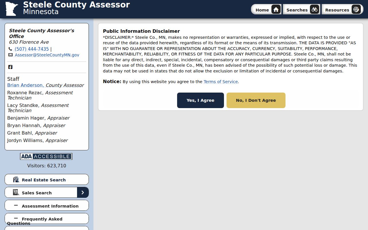
The Steele County Assessor residential search is useful once an address, parcel number, or legal description is known. The Assessor's published guidance identifies Address, Parcel Number, Doing Business As, Legal Description, Section, Township, Range, Lot, and Block as searchable concepts. Its entry screen uses a consent gate, and the research did not capture the live ZIP field order or prove a ZIP-wide result list. Do not promise that a ZIP alone will return every property or person.
The assessor entry screen records the consent step before the property-search interface.
Once a parcel result is available, compare it with GIS geometry and use the Recorder for title evidence instead of treating the assessment display as a resident list.
Owatonna ZIP Code Boundaries
ZIP boundaries and Owatonna city limits do not match by default. Postal delivery can serve addresses outside the city, and nearby routing material can mention Owatonna without placing an address in city geography. For a parcel near an edge, use the city GIS Municipal_Boundary layer and county GIS tax-parcel context. The Owatonna ArcGIS MapServer includes Municipal_Boundary, Parcels, BuildingFootprints, Sub-Divisions, and other city layers that help keep the questions separate.
The Census Owatonna profile describes city geography, not a ZIP delivery footprint. Do not add a ZCTA total to an Owatonna city total or use a ZIP centroid as a city boundary. For 55049, 55053, and 55057, the researched evidence requires an address-level USPS check before any Owatonna coverage statement.
Owatonna Postal Terms
Postal terms help explain why a valid address can still need a parcel or boundary check.
- ZIP Code
- A Postal Service routing code used to sort and deliver mail; it is not a municipal boundary.
- ZIP+4
- An added four digits that can refine delivery routing for a particular address or segment.
- PO-box ZIP
- A ZIP used for post office box delivery, which may not describe a physical street location.
- Unique ZIP
- A ZIP assigned for a single institution or delivery purpose, if USPS documents it for that address.
- Carrier route
- A delivery sequence used for mail operations, not proof of city jurisdiction or residence.
Owatonna Postal Research Gaps
No Owatonna-specific ZIP realignment history, complete post-office-box inventory, unique-ZIP inventory, or historical Postal Service boundary map was located in the research. The 2025 Postal Bulletin material for 55053 and 55057 is useful as routing or container evidence only. It cannot draw a current residential footprint or demonstrate that either ZIP is within Owatonna city limits. The research also did not verify a public ZIP-wide Assessor result screen after the consent gate or a city-specific ZIP boundary change.
That absence is a reason to narrow the question, not to fill the gap with a static third-party map. Use USPS address validation for the current delivery assignment, city and county GIS for mapped jurisdiction and parcels, and the Assessor or Recorder for property context. Preserve the result date, full address formatting, ZIP+4 where returned, and the map layer date. A ZIP assignment, a city boundary, and a parcel description can each change on separate schedules and at separate times.
Owatonna ZIP Code Directory Limits
No Owatonna postal directory can verify every person at a delivery address. USPS limits its result to delivery information. An assessor display is a property record, a city GIS map is reference geometry, and the voter tool has an individual match design and statutory controls. Safe at Home and protected voter information must not be inferred from an absent result.
For a missing property or boundary detail, contact the Assessor at 507-444-7435 or Steele County GIS at 507-444-7486. For an existing government-data request, identify the department, address or parcel, date range, record type, inspection or copy preference, and requested format under the Minnesota Government Data Practices Act. Do not ask an office to create a new ZIP-wide resident list.